In this article, we explore three key metrics that define the image quality and resolution of a drone camera. To help clarify these concepts, we'll focus on the cameras found in our drones: the Elios 1 and Elios 2.
Pixel Resolution
The
pixel resolution refers to the number of pixels in an image, typically expressed as width x height (e.g., 1920 x 1080) or as total pixels (e.g., 2.1 MP). This metric tells us how large an image is, but it doesn't directly indicate how much detail can be seen or how big objects appear in the image.
| Elios 1 Pixel Resolution |
| FHD video |
1920 x 1080 |
2.1 MP |
| Elios 2 Pixel Resolutions |
| FHD video |
1920 x 1080 |
2.1 MP |
| 4K video |
3840 x 2160 |
8.3 MP |
| Photo |
4’000 x 3’000 |
12 MP |
While pixel resolution gives you a sense of image size, it's not enough to determine how detailed or clear the image will be. For that, we need other metrics like ground sampling distance and spatial resolution.
| Metric |
Application |
| Pixel resolution |
Storage, display, digital zoom |
| Ground Sampling Distance (GSD) |
Measurements, photogrammetry |
| Spatial resolution |
Object detection, detail characterization |
Ground Sampling Distance (GSD)
The
ground sampling distance (GSD) is the real-world distance between two adjacent pixels in an image, measured in mm per pixel. A GSD of 1mm/px means one pixel represents 1 mm on the object. The smaller the GSD, the more detail you can see.
However, GSD is affected by the distance from the object. As the drone gets closer, the GSD decreases, making objects appear larger. With a fisheye lens, GSD also varies across the image—objects in the center have a smaller GSD than those at the edges.
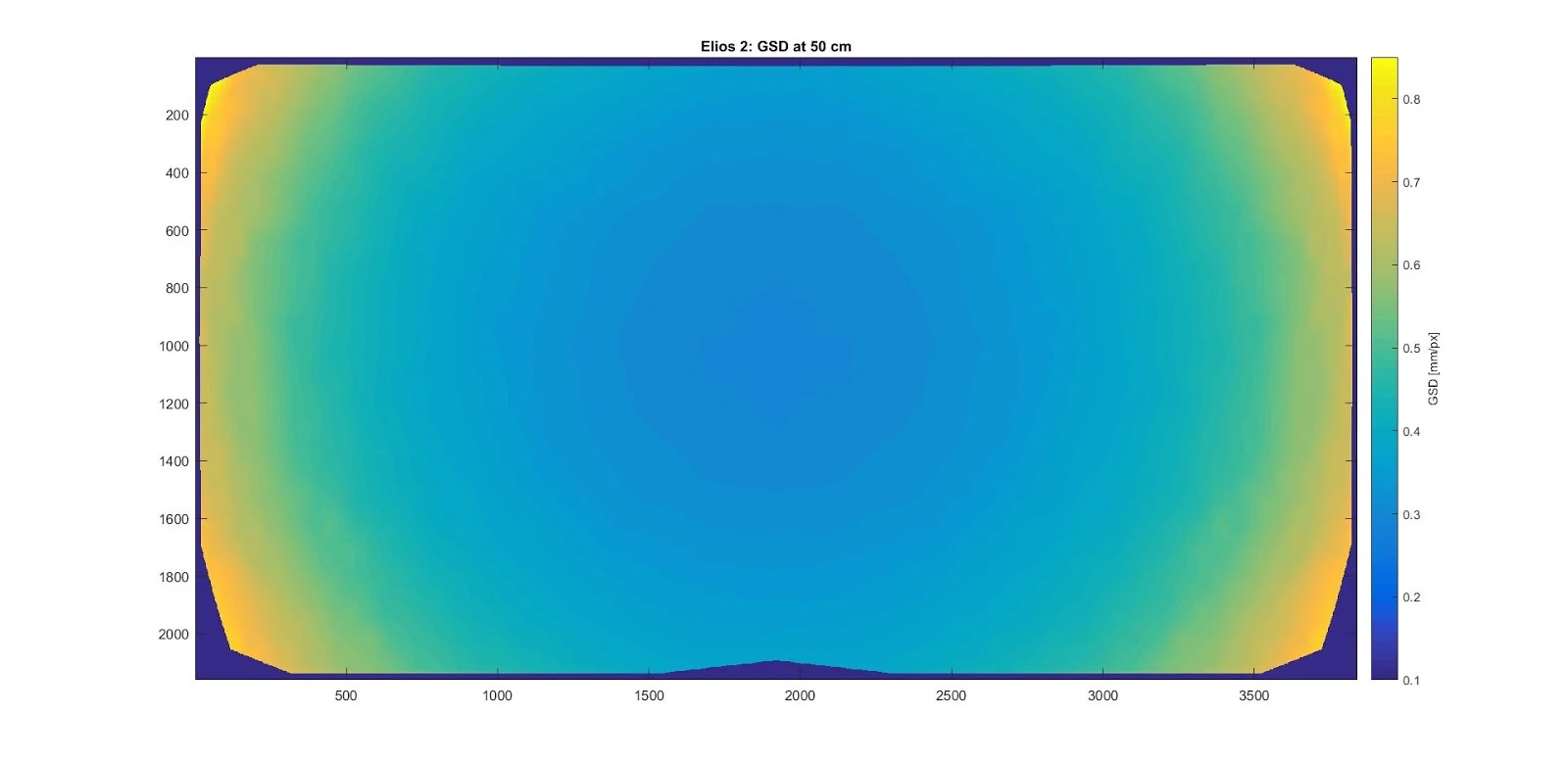
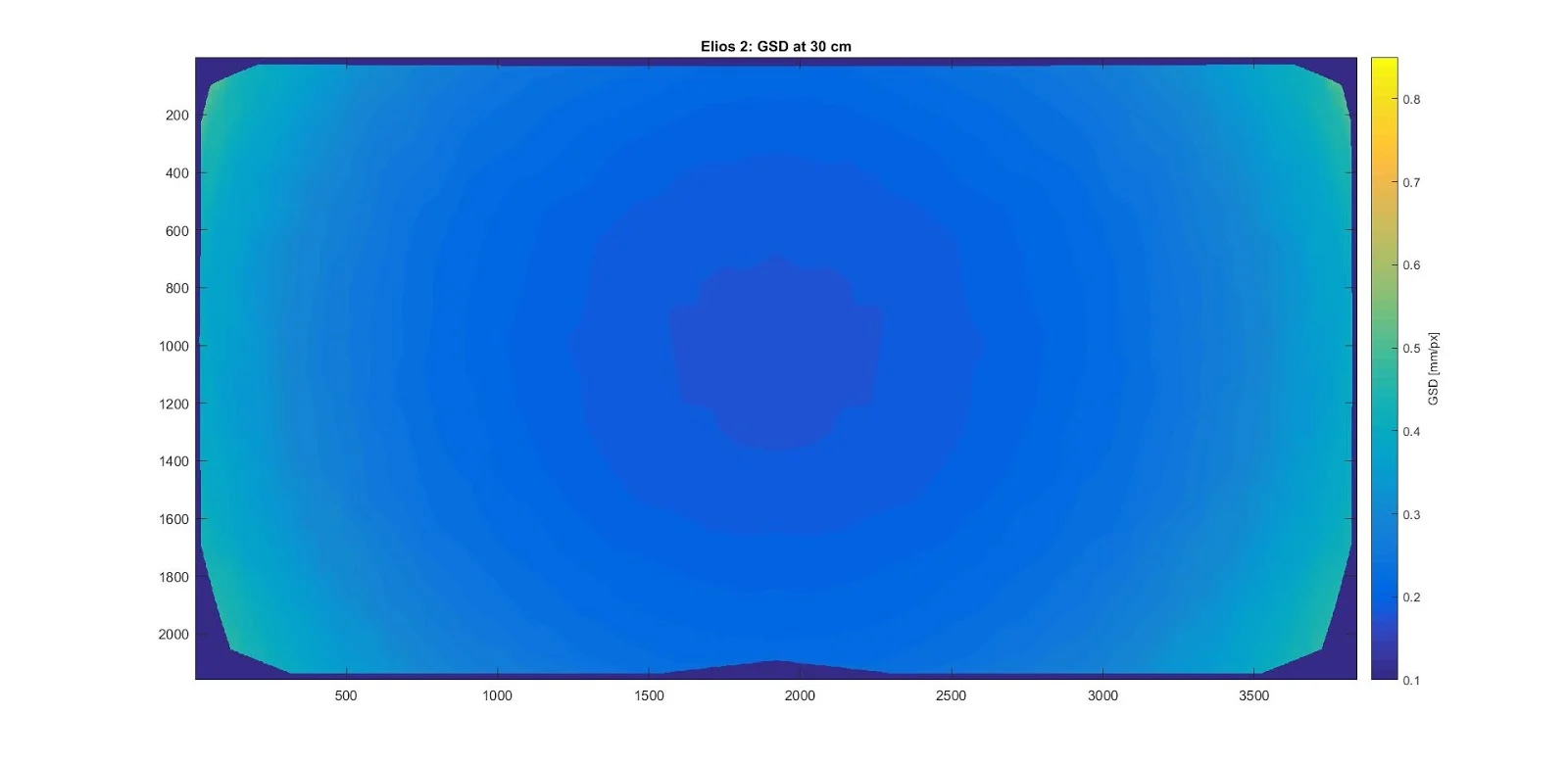
This shows how GSD changes across the image when the Elios 2 is facing a flat wall. While GSD is important for measurements, it doesn’t fully capture image quality or detail visibility.
Spatial Resolution
The
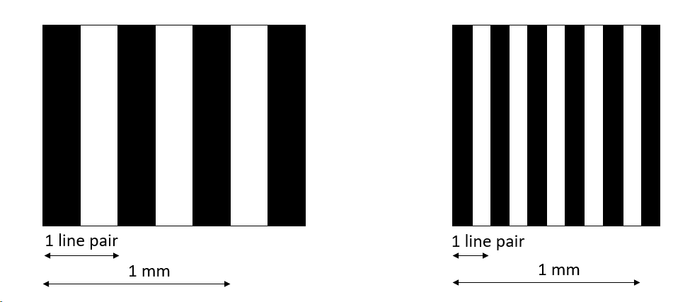
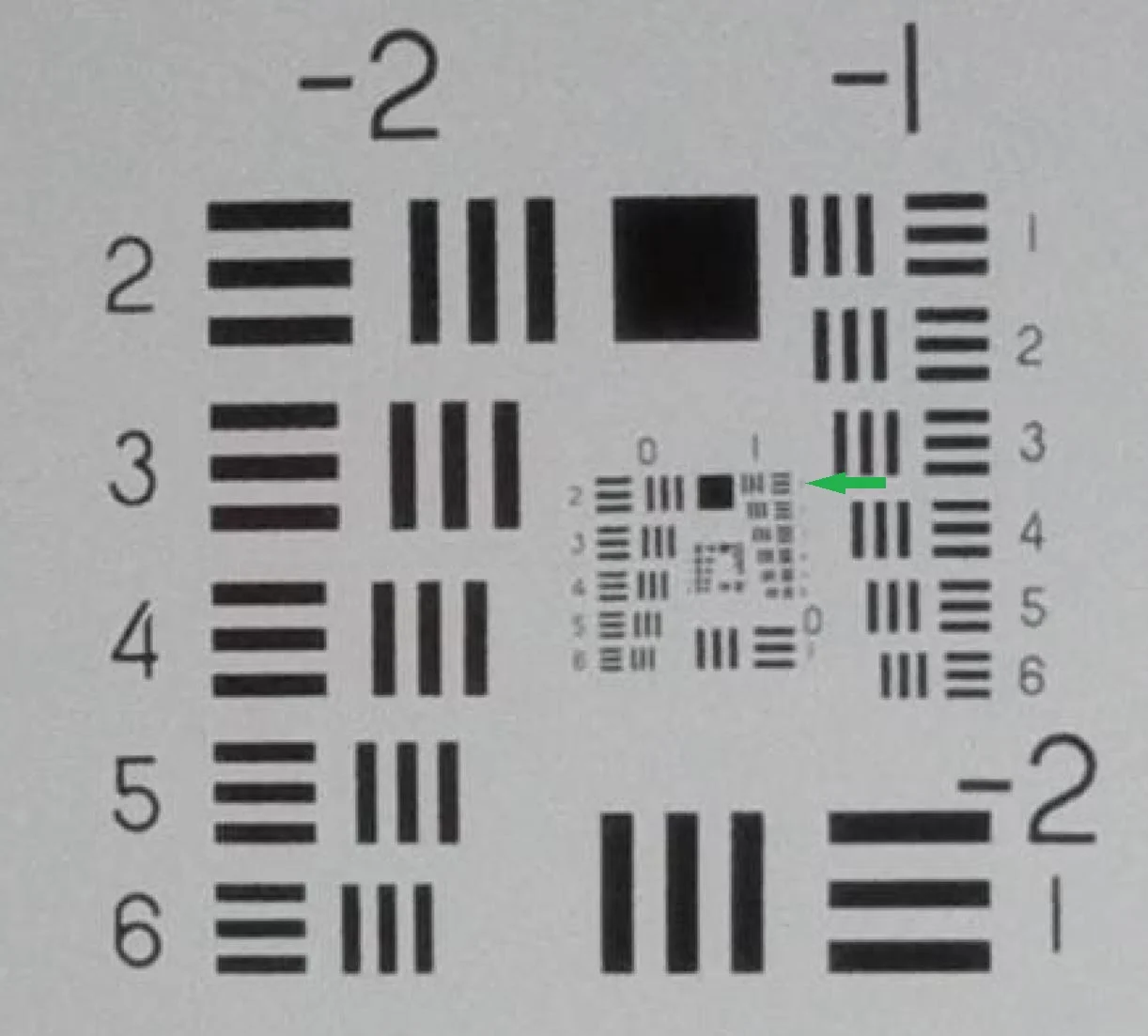
spatial resolution describes the smallest details visible in an image. It’s often measured in line pairs per millimeter (lp/mm), which indicates how many alternating black and white lines can be distinguished.
For example, a spatial resolution of 2 lp/mm means you can see 2 cycles of black and white lines per millimeter. Higher values mean better detail visibility.
The Elios 2’s spatial resolution is highest in the center and decreases toward the edges. It also depends on focus and lighting conditions. Flying too close can cause blur, reducing resolution, while flying too far makes details harder to see.
The optimal distance for Elios 2 is 30 cm. At this point, the spatial resolution is best, and the image remains sharp. The Cockpit app helps pilots maintain this distance with visual feedback via color codes:
| Distance |
Color |
Meaning |
| > 40 cm |
 |
White |
Going closer improves resolution |
| 30–40 cm |
 |
Green |
Best resolution and clarity |
| 20–30 cm |
 |
Orange |
Good resolution, slightly blurred |
| < 20 cm |
 |
Red |
Image is blurry and less detailed |
Other factors also affect image quality, such as lighting, stability, and lens cleanliness. Proper setup ensures the best possible results. The Elios 2’s compact design and advanced lighting system allow for detailed inspections from multiple angles, enhancing its ability to detect defects and irregularities.
Understanding these metrics helps improve your data capture and overall image quality. Whether you're inspecting infrastructure, performing surveys, or capturing high-resolution footage, mastering these concepts will greatly enhance your drone operations.
Bicycle Freewheel
bicycle freewheel,single speed freewheel,fixed gear bike freewheel,BMX freewheel,aluminium alloy freewheel
Suzhou Jingqiyao Intelligent Technology Co., Ltd. , https://www.polsobike.com